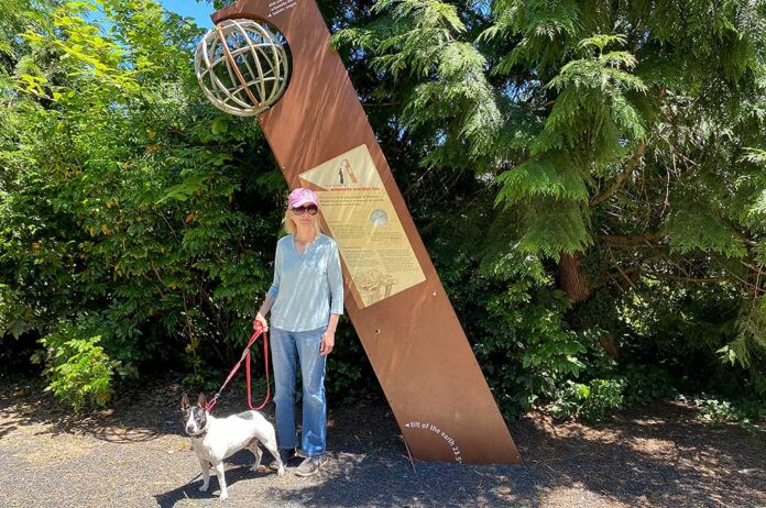
Dog-walkers and joggers who traverse the Tualatin River Greenway along the Tualatin River behind the Stonesthrow Apartments often don’t even notice a 10-foot-tall piece of metal sticking out of the ground at an angle.
But its significance can’t be overestimated.
It marks the Willamette Meridian Line, which was established in 1851 and extends from the Canadian border to the northern state line of California, according to the Center for Land Use Interpretation.
The City of Tualatin erected the monument after members of the Tualatin Historical Society requested that 65th Avenue also be called Meridian Road because the street’s alignment follows the Meridian line. The marker was dedicated June 20, 2008.
A sign on the Tualatin marker reads, “As you stand on this meridian line, set your compass for due north (true north, not magnetic north) and follow the needle from this point past the Tualatin River, over the hills north of Tualatin, across a maze of highways, country roads, and suburban streets, and into a park in the West Hills of Portland. If you’ve followed your compass faithfully, your path will lead you to a small monument called the Willamette Stone.
“Two surveying lines cross paths at the Willamette Stone: An east-west line known as the Willamette Base Line, and the north-south line known as the Willamette Meridian, where you are standing. This line is also the Washington-Clackamas county line.”
The Tualatin marker further explains that immigrants who arrived in the region in the early 1800s were granted up to 320 acres each to homestead. There were no formal surveys or divisions of land, leaving the settlers to simply choose the plot of land they desired.
But as more arrived to stake their claims, a formal system of land division was introduced. Based on the Land Ordinance of 1785, this system established rectangular townships of 36 square miles each. Townships were based on the Willamette Meridian and the Willamette Base Line. Each township encompassed 36 “sections” of 640 acres each. A family or married couple could claim a section to homestead.
According to the Oregon Encyclopedia, a project of the Oregon Historical Society, in 1850, two years after Oregon had attained territorial status and became part of the nation’s public domain, Congress passed the Donation Land Act to resolve problems caused by escalating immigration, preemption settlement and land claims. The primary purposes of the act were to create the Office of Surveyor-General of Oregon, to provide for the survey of public lands, and to make donations of public lands to settlers.
The act also set into motion the direct involvement in the Oregon Territory by the United States General Land Office, which was charged with the administration, survey and disposition of public domain lands. Land surveys, also known as cadastral surveys, were necessary before the public domain could be conveyed out of federal ownership.
The first surveyor-general of Oregon, John B. Preston, opened the GLO survey office for the Oregon Territory in Oregon City on May 5, 1851, and secured a staff of cadastral surveyors.
The GLO commissioner advised Preston to establish the initial point of the survey so the Willamette Meridian would run north to Puget Sound and south to California, passing between Vancouver Lake and the Columbia River to keep the meridian out of those two waterways as much as possible. The Willamette Base Line, running east to the Snake River and west to the Pacific Ocean, was to be positioned south of the Columbia River and north of Mount Hood and across the Tualatin Plains.
The surveyors selected a high point on a ridge along the Tualatin Mountains (known today as Portland’s West Hills) for the intersection of the meridian and base lines and the location of the survey’s initial point.
The Willamette Stone was sited on June 4, 1851, and in the following years, government and private surveyors traveled throughout the region, pacing along imaginary grid lines oriented around the Willamette Meridian, which was selected as the only principal meridian necessary to survey all of what is now Oregon and Washington.
The surveyors took meticulous notes on significant landmarks, buildings, roads, vegetation, waterways and other features along the section lines. Their observations were later turned into the first official maps of the county.
In 1946, the GLO’s successor, the Bureau of Land Management, became the custodian of the official survey records and is responsible for conducting re-surveys and new surveys of public lands. Land surveys conducted by county and private surveyors must be tied to the original surveys.
In Washington County, there are around 3,400 land markers, most of them out of sight and buried. Since many of them were originally made of materials that disintegrated over time, the county is replacing them with brass caps set in concrete.


